Earthquakes change river courses
An international team of scientists including, PLUS geologist Christoph von Hagke, has discovered that around 2500 years ago, an earthquake abruptly changed the course of the Ganges (India). The natural event diverted the main channel of the Ganges in what is now Bangladesh, causing a so-called “river avulsion” that drastically changed the landscape of the time. An earthquake of a similar scale would be a catastrophe for the region today. The results will help us make more accurate predictions of natural hazards and their effects. The study has just been published in the journal Nature Communications.
“Earthquakes are among the best-studied geohazards,” says Christoph von Hagke, geologist at the Paris Lodron University of Salzburg. It is also known that disruptions to the river system, such as the collapse of dams, can have catastrophic consequences. “However, it was still largely unknown that earthquakes can lead to river avulsions, i.e. changes in river courses, especially in delta estuaries. And this applies to a river as large as the Ganges,” says von Hagke. Bangladesh is one of the most densely populated landscapes in the world. A new earthquake of this magnitude could cause flooding and widespread softening of sand deposits and ground shaking. This could have a dramatic impact on millions of people who currently live in the floodplain of the Ganges.
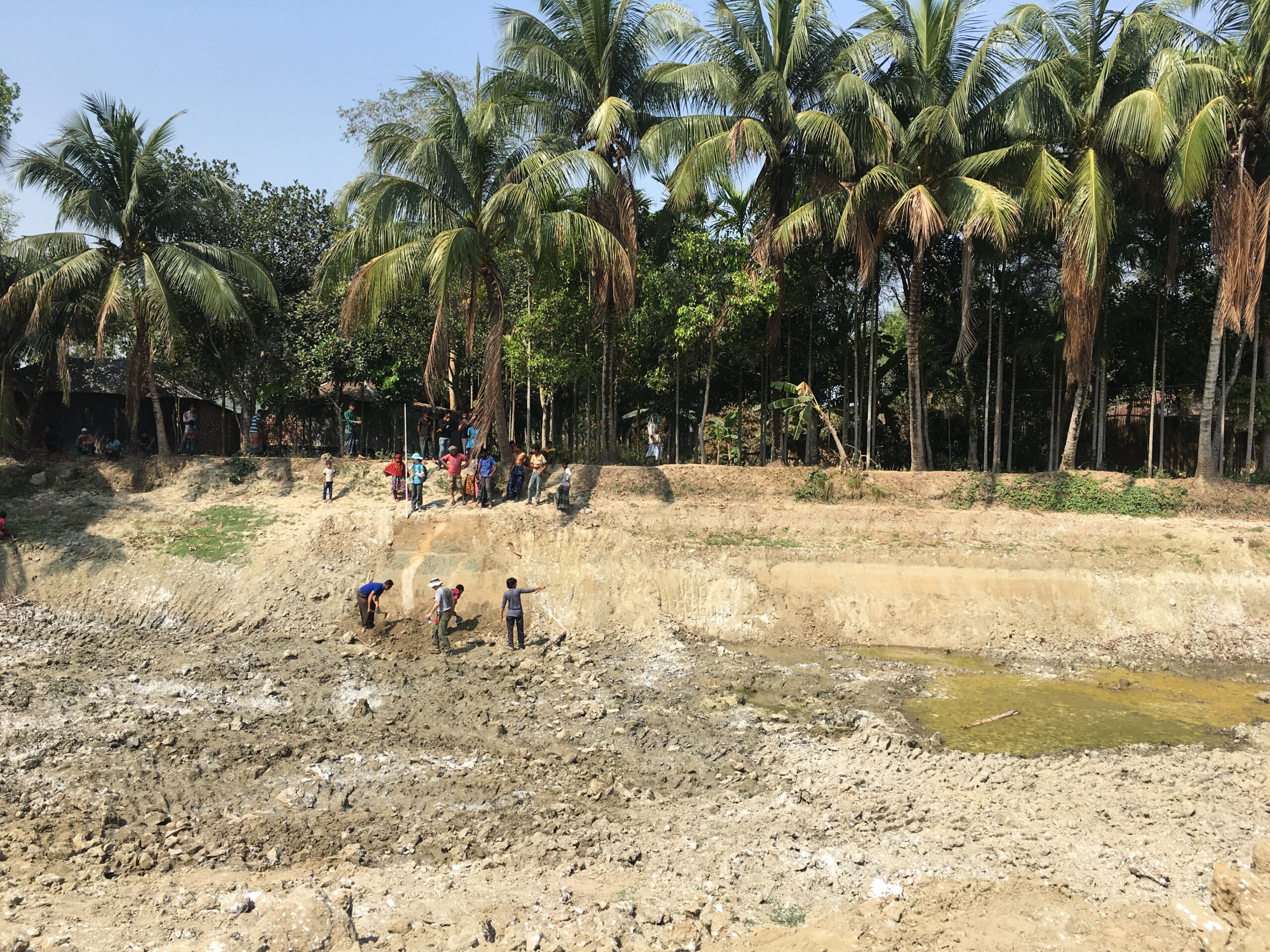
Sand dikes in the sediment reveal signs of an earthquake
The earthquake and the river avulsion were reconstructed by analysing sediments. Sustained shaking during an earthquake can force pressurised sand at depth into overlying clay layers. This phenomenon can be observed in the soft sediments of delta estuaries as vertical sand dikes or “seismites”. Similar examples can be found all over the world.
The extent of the earthquake was determined by correlating the width of the sand dike and the distance to the possible earthquake centre. Optically stimulated luminescence dating was used to determine the time of the earthquake. “In this case, we found extensive 30-40 centimetre wide sand dikes that had broken through a 3-4 metre thick overlying clay layer. The extent of these sand dikes and their location more than 180 kilometres from the nearest probable seismogenic zones indicate a prehistoric earthquake that probably reached magnitude 7-8 on the Richter scale,” says von Hagke. An interdisciplinary team of scientists with expertise in structural geology, tectonics, sedimentology, age dating and regional geological understanding was needed to find this out. So it was a very strong earthquake and had a corresponding impact on the Bengal Delta.
Landscape reconstructions provide a glimpse into the past
In addition to the sand channels, the scientists discovered a 1.5 kilometre wide, abandoned river arm, which was also dated to an age of 2,500 years. “The size and chemistry of the river arm deposits show that this was the main arm of the corridor that was suddenly abandoned,” says von Hagke. Landscape reconstructions are a puzzle with many unknowns, but they have the great advantage that they provide a glimpse into the past. This makes it possible to recognise processes and dynamics on the earth’s surface that take place over very long periods of time and at intervals with little repetition that are not contained in modern and historical records. A prime example of this is this river avulsion triggered by an earthquake.
Better prediction of natural hazards and their effects
Geological shifts can cause considerable damage, such as the tsunami in the Indian Ocean in 2004, which was triggered by an underwater earthquake, claiming around 230,000 lives. “Archives on prehistoric tsunamis did exist in Indonesia, but they had not yet been sufficiently analysed to provide timely warning of the tsunami,” says von Hagke. “This study clearly shows how basic research can improve our ability to predict natural hazards and their impacts,” says Justin Lawrence, programme officer at the U.S. National Science Foundation, which funded this work.
The research was conducted in collaboration with colleagues from the University of Dhaka, Bangladesh Open University, Bangladesh University of Professionals, University of Cologne and Paris Lodron University Salzburg. Additional funding was provided by the U.S. National Center for Earth Surface Dynamics and the Graduate School for Production Ecology & Resource Conservation at Wageningen University & Research.
Study: Cascading hazards of a major Bengal basin earthquake and abrupt avulsion of the Ganges River.