News and current events
Z_GIS is active on various social media channels. Keep an eye on them to get important and interesting news about research, teaching and events
Visit our social media:
News
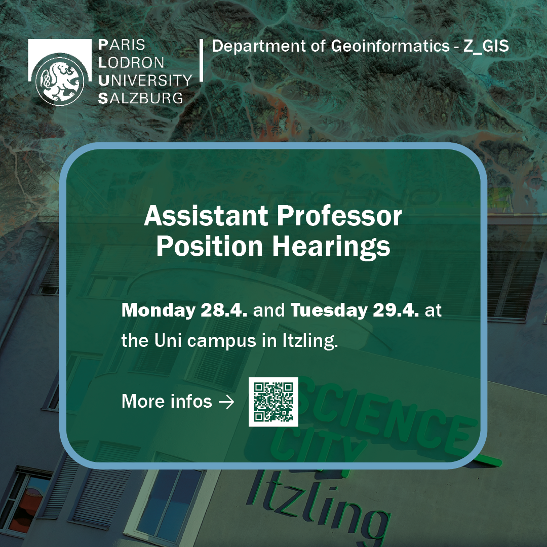
Save the date 28.-29. April 2025: Assistant Professor Position Hearings at the Department of Geoinformatics – Z_GIS
Monday, 28 April
Lise Meitner lecture hall, Itzling
- 10:30: Dr.-Ing. Yu Feng, TU Munich, Generative Artififi cial Intelligence for Geospatial Data
- 11:30: Dr. Timo Homburg, Martin-Luther University Halle-Wittenberg: Towards a 3D Geospatial Semantic Web for GeoAI Applications
- 14:00: Ass.-Prof. Dr. Jascha Grübel, Wageningen University: Generic Spatial Data Science Systems -Technology for geoAI, Open Science, and Society in the 21st Century
Tuesday, 29 April
GI_lecture room, Itzling
- 9:00: Dr. Martin Sudmanns, University of Salzburg: Spatio-temporal semantic analysis in big Earthobservation data infrastructures
- 10:00: Dr. Merve Keskin, University of Salzburg: Sensing Human, Sensing Environment and PersonalizingGeo-Experiences: A Gaze-Based Approach to Adaptive Cartographic Interfaces
The presentations are open to everyone interested. Members of the department, students and curious colleagues from otherdepartments are particularly encouraged to participate and to find out about potential future colleagues!
25.10.24 – Digital transformation in indigenous communities in Latin America
Our researchers Sebastian Schmidt and Umut Nefta Kanilmaz recently had the great opportunity to actively participate in workshops on the topic of digitalisation in indigenous communities in Latin America.
As part of ADELANTE2, an EU funding programme, a project („Contribución a la Transformación digital en Comunidades Indígenas„) was supported that aims to promote digital transformation in indigenous communities in Latin America. In this context, Sebastian Schmidt and Umut Nefta Kanilmaz were able to give members of various indigenous communities from Panama, Ecuador and Argentina insights into geoinformatics data and methods. Particularly in the area of satellite remote sensing and freely available geodata, they showed how this data could be used to overcome difficulties in relation to territorial issues, environmental quality and climate change. There were two workshops, one in Panama City and one in Quito, in which several members of indigenous communities took part in person to gain practical experience with GIS tools.
„My most important takeaway from this project is that we as researchers need to think much more about the end use in our activities. There are numerous urgent problems, ranging from contamination of drinking water, deforestation and illegal hunting to the lack of presence of indigenous communities in national and international organisations. Our research in geoinformatics and related sciences – or even better in the context of interdisciplinary projects – must be geared towards being able to help here“ says Sebastian Schmidt, who is also a PhD student at Z_GIS.
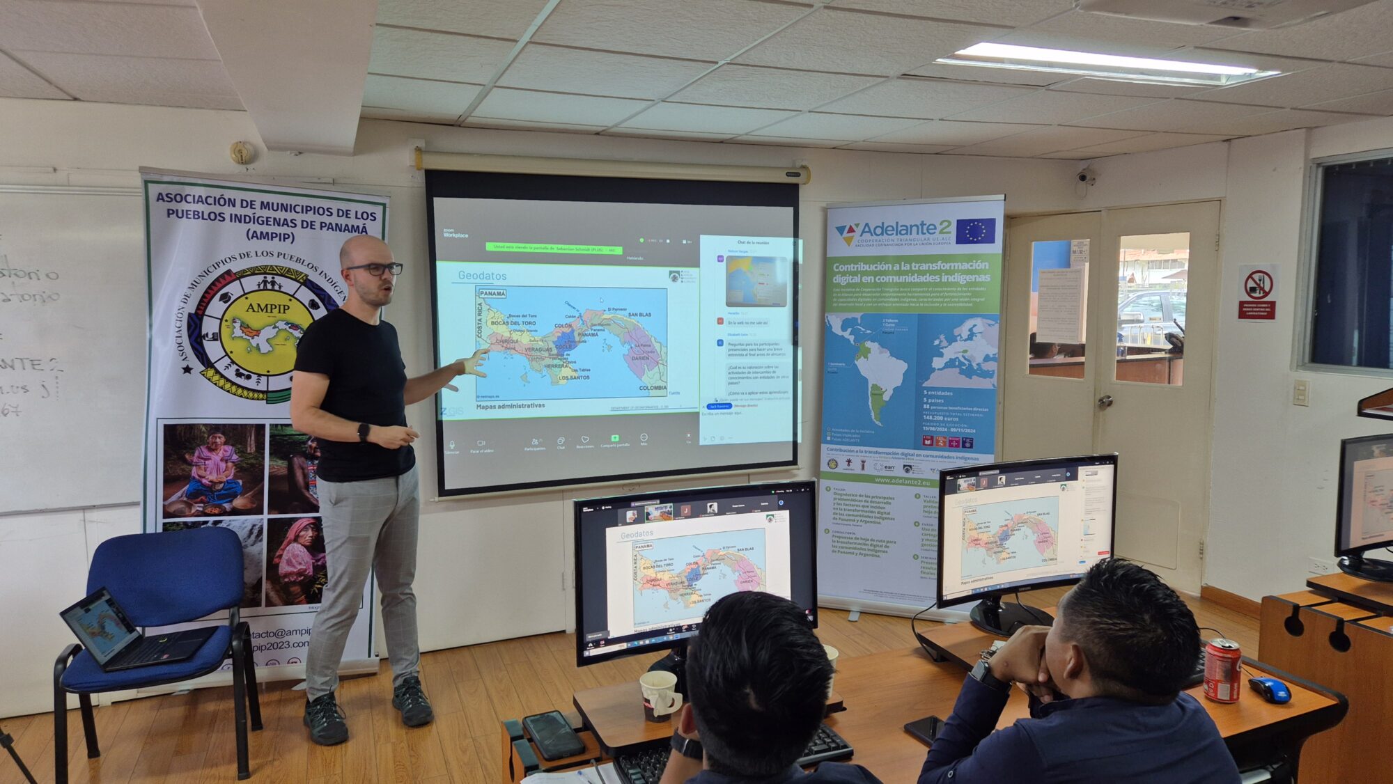
We would like to thank in particular all participants from the indigenous communities from Panama, Ecuador and Argentina for their active participation, the high level of interest and the incredibly fascinating exchange! Discussions with potential beneficiaries of our scientific developments was an extraordinary experience. We would also like to thank Elizabeth León Velásquez, Leo Zurita Arthos and Bárbara Constantinidis Migoya, who were responsible for organising the workshops on behalf of the Universidad EAN, the Universidad San Francisco de Quito and ESRI Panamá.
12.03.24 Antrittsvorlesung
Am Montag 8. April 2024 ab 17:15 Uhr stellt sich Univ.-Prof. Dr. Johannes Scholz vor, der seit 1.2.2024 bei uns Professor für Geoinformatik ist.
Ort: Science City Itzling, Hörsaal “Lise Meitner“ (Jakob-Haringer-Straße 2A, UG).
Anmeldung bis 25. März per Email – Details gibt es hier.
08.03.24: Position Announcement: Researcher for SpongeCity project
The Department of Geoinformatics – Z_GIS at University of Salzburg is offering a researcher position in the SpongeCity project ( spongecity.sen2cube.at) with the focus on big Earth Observation data analytics.
Job profile:
Collaboration in an international research project
- Active participation in project meetings.
- Responsible for technical-scientific tasks in the SpongeCity project.
Research in Earth observation, big EO data infrastructure, and artificial intelligence.
The researcher will join an interdisciplinary team of researchers who are focused on Earth Observation and Geoinformatics.
- Start of the position: ASAP
- Duration of contract: at least 2 years (extension possible and envisaged, depending on available project funding)
- Weekly working hours: 30h
- Professional level (preferred): predoctoral (holding a MSc degree) with option to do a PhD
For more information, see the full announcement.
17.08.23: Position Announcement: Researcher in the EO Analytics Lab (filled)
The Department of Geoinformatics – Z_GIS at University of Salzburg aims to combine high quality education with excellent research. The department has several research groups with an outstanding international reputation (https://zgis.at/research) and is offering a researcher position in the EO Analytics Lab research group (https://eo-analytics.zgis.at).
The researcher will join a multidisciplinary team of educators and researchers who are focused on Earth observation and Geoinformatics.
• Start of the position: November (or earlier)
• Duration of contract: at least 2 years (extension possible and encouraged, depending on available project funding)
• Weekly working hours: 30h
• Professional level: Preferred: Predoctoral (holding a MSc degree) with option to do a PhD
For more information, see the full announcement.
25.07.23: Edition 2023
Die 2023 Ausgabe der Z_GIS Broschüre ist jetzt online verfügbar.
28.04.23: AIFER: Künstliche Intelligenz für Katastrophenschutz
Im Rahmen des mehrjährigen Forschungsprojekts AIFER wird unter Projektleitung von Prof. Bernd Resch vom Fachbereich Geoinformatik der Paris Lodron Universität Salzburg ein System entwickelt, welches mit der Unterstützung von KI Katastrophenlagen erfasst und auswertet.
Mehr zu diesem spannenden Projekt gibt es auf dem Blog des Techno-Z, und auf der AIFER Projektseite.
20.04.23: U3green: Jugendliche entwickeln web-basierten Fragebogen zur Gestaltung von Grünflächen im städtischen Raum
Das Forschungsprojekt u3green untersucht, wie Jugendliche und Kinder Grünflächen im städtischen Raum nutzen und bewerten. Geht es beispielsweise um Entspannung und Erholung oder sportliche Aktivitäten? SchülerInnen von Partnerschulen in der Stadt Salzburg entwickeln gemeinsam mit ForscherInnen des Fachbereichs Geoinformatik der Universität Salzburg eine interaktive App, um sich mit diesen Themen auseinanderzusetzen. So sollen die Meinungen und Erfahrungen der jungen Menschen in die Untersuchung einfließen.
Mehr dazu gibt’s auf unserem Blog.
18.04.23: UNI-Blog: Studiengang „Digitalisierung – Innovation – Gesellschaft“ – was ist das?
Im neusten Uni-Blogbeitrag berichtet eine Studentin der Studienrichtung „Digitalisierung – Innovation – Gesellschaft“ am Fachbereich Geoinformatik der Fakultät für Digitale und Analytische Wissenschaften von ihren Erfahrungen mit dem Studium.
07.03.23: Wanted: Scientific senior researcher for the research group “Geo-Social Analytics Lab” (filled)
The Department of Geoinformatics offers a scientific senior researcher position within the research group “ Geo-Social Analytics Lab”.
Job profile:
Collaboration in international research projects Acquisition of research funding (conceiving and writing grant proposals)
Project lead and supervision
Research in geospatial machine learning and artificial intelligence Analysis of user-generated data like geo-social media posts or physiological measurements, information fusion
Semantic topic modelling using AI methods
Sentiment Analysis (emotion and opinion mining in text data)
Application contexts: disaster management, humanitarian aid, epidemiology, urban planning
The researcher will join a multidisciplinary team of researchers and educators in the field of Geographic Information Science and Geoinformatics.
Start of the position: ASAP
Duration of contract: 2 years (extension possible and envisaged)
Weekly working hours: 30-40 h
Professional level: Preferred: postdoctoral (holding a PhD degree)
Possible: predoctoral (holding an MSc degree) with exceptional qualification
Working hours: to be arranged
Candidates are required to hold a degree in the field of artificial intelligence, data science, geoinformatics, computer science, information management or a related discipline. Moreover, an excellent research and publication record, and the ability to work independently and in teams are mandatory.
Details see pdf: English | German
If you are interested in this position, please contact Prof. Dr. Bernd Resch (bernd.rMf6res.nBvch@pluOwbSs.ac.ayYu5tKNso) or by phone: +43-662-8044-7551.
08.02.23: UNI-Blog: Studienergänzung „Geographische Informationssysteme (GIS)“ – was ist das?
Manfred Mittlböck stellt das Programm in der neusten Uni-Blog Folge kurz vor.

